Wreckhunter.net

Hunting New England Shipwrecks

Lightburne

Click on thumbnail image for a larger view
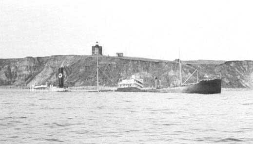
lightburne-quinn.JPG (17452 bytes)

ess-lig-quinn.JPG (23691 bytes)

Tanker Lightburne
off Southeast Point
(Bill Quinn collection)

 Lightburne (center)
Essex (right)
(Bill Quinn collection)

The table below provides historical and statistical data on the vessel. Some of the information may be incomplete. If you have additions or corrections, please e-mail us at the address listed below.

Shipwreck Data

Vessel Name Lightburne
Other Names  
Vessel Type Tanker
Owner Texaco
Length / Beam / Draft (feet) 416' / 56' / 31'
Tonnage 6,429
Hull Construction Steel
Propulsion Steam / Prop
Cargo Kerosene and gasoline
Built 1919 at Bath, ME
Date of Loss February 10, 1939
Reason for Loss Grounded on rocks
Fatalities None
Location Block Island, RI, ¼ mile SE of Southeast Point lighthouse, inside can buoy #1, wreck symbol marked on NOAA chart
Coordinates (Lat/Lon) 41-08-58N / 71-32-54W
Coordinates (Loran C)  
Water Depth (feet) 30' Maximum
Typical Visibility (feet) 10 - 30'
Wreck Condition Broken up and partially buried in sand
Diving Considerations An easy dive, accessible only by boat
Other Information The freighter Essex (sunk in 1941) lies just southwest of the Lightburne (see Essex)
Attention Divers
The information on this page was obtained from a variety of sources. Although we have attempted to make it as accurate as possible, it may contain errors.  For your personal safety, use extreme caution when diving on this wreck.

For more information on this wreck's location and history, and water and diving conditions in the area, contact local dive shop personnel, dive charter boat operators and local fishermen. Also check out the other shipwreck Websites listed on our Favorite Links page.


To go to other pages on this site, use the Site Navigator at left, or click here to go to our Home Page.

Comments or questions
editor@wreckhunter.net

Copyright © 2001 by Dave Clancy
All Rights Reserved