|
Shipwreck Data |
| Vessel
Name |
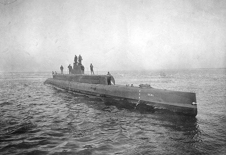
USS
G-1 |
| Other Names |
Seal
and SS-19½ |
| Vessel
Type |
Submarine |
| Owner |
U.
S. Navy |
| Length
/ Beam / Draft (feet) |
161'
/ 13' / 12' |
| Tonnage |
380 |
| Hull
Construction |
Steel |
| Propulsion |
Diesel
/ Electric / Screw |
| Cargo |
|
| Built |
1911
at Newport News, VA |
| Date
of Loss |
June
21, 1921 |
| Reason
for Loss |
Blown
apart in Navy
depth charge experiment |
| Fatalities |
None |
| Location |
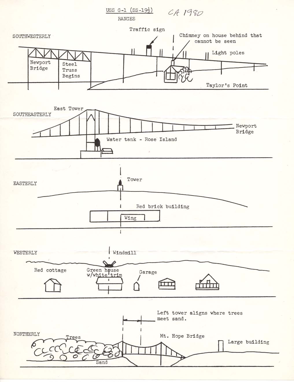
Narragansett
Bay East Passage - off
Taylor Point, Jamestown, RI
625 yards 42° T from Taylor Point (per U.S. Navy records)
See location range document above |
| Coordinates
(Lat/Lon) |
41°
30.889' N / 71° 21.246' W |
| Coordinates
(Loran C) |
|
| Water
Depth (feet) |
100' |
| Typical
Visibility (feet) |
Usually
poor (0 - 5') |
| Wreck
Condition |
Partially
intact, mostly buried in mud |
| Diving
Considerations |
A
dangerous dive due to depth, poor visibility and strong currents |
| Other
Information |
|