Are you looking for shipwreck information? NOAA's AWOIS database (Automated Wreck and Obstruction Information System) is a great and free research tool for wreck hunters. Its contents are quite extensive, and using it is easy. The regional database files (see regions map below) are available for download from the AWOIS website, and once downloaded, the data is automatically displayed in a Google Earth window. In order to display the data, you must have Google Earth software installed on your computer. Once you have the software installed, clicking on a database icon will open a Google Earth window showing the wreck and obstruction placemarks. You can then click on any of the markers to display the data.
To go to the AWOIS website, click the link below. The site contains a helpful Users Guide, and links for downloading the files. Good luck with your research!
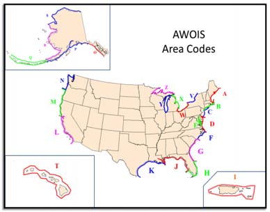
AWOIS regions map
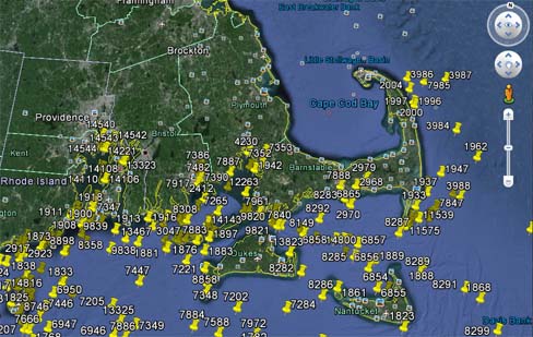
AWOIS region B overview - in a Google Earth window
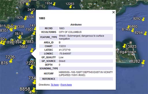
A typical AWOIS data display
To go to other pages on this site, use the Site Navigator
at left, or click here to go to our Home Page.